


production Strider 24

plywood Romany 34

lightweight 14ft Zeta mainhull

Strike 15 trimaran at speed

28ft Skoota in British Columbia

10ft 2 sheet ply Duo dinghy
24ft Strider sailing fast

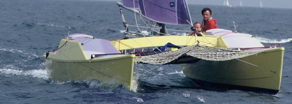
36ft Mirage open deck catamaran
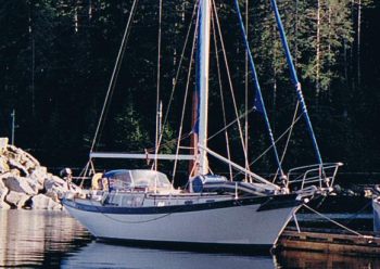
Monohull Cruising in Alaska
From Latitudes and Attitudes, March 2006
"Wave" I shout and we all duck, but Mel is too late. The bows have already dropped and a 14ft high wave washes back over the catamaran completely hiding the decks and sending icy water down Mel's unprotected neck.
The wind has been slowly increasing, it's now a steady 40 knots and we are down to a triple reefed mainsail and deeply rolled genoa. Even bashing to windward in the reinforced winter trades off Honduras was never like this! At 2 am we have had enough - we have all been shivering for hours and it seems there will be little chance of improvement before dawn.
So we turn back and run downwind in a pitch black night under the reefed genoa alone. Eventually at 4 am we drop anchor in Weymouth harbour, which we had sailed past exactly 12 hours earlier.
If this was a typical sail in early summer in the English Channel, what would sailing in Alaska be like? Two weeks later I found out.
We have been cruising around the Caribbean in our 32ft catamaran Eclipse for the last couple of years. It's a great place to sail in the winter but each spring we have had to find a safe hurricane hole for the summer. In 2004 we were in the Rio Dulce, Guatemala, but found that it was just too hot to stay comfortable on a boat without air-conditioning. We cruised Panama in early 2005 and were determined to get off the boat for the summer, as Panama is even wetter and more humid than Guatemala. So where to go?
I'd always wanted to sail in British Columbia and luckily we met Ty who needed crew to help sail his Downeast 38 monohull south from Wrangell in Alaska. This was further north than we had intended to go, but it sure would make a change from the tropics! My previous sailing experience on monohulls included a transatlantic on a Swan 55 and working on Caribbean charter boats, but this would be my first long cruise on one for 25 years, so that added spice to the trip.
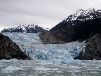
Before meeting Ty we took the ferry to Juneau, Alaska's capital, for a spot of sightseeing for, apart from its wild life, Alaska is also famed for dramatic scenery and, especially, glaciers. Of these, the ones in Glacier Bay are the most famous, but many people told us that the Seymour Glaciers in Tracy Arm were more spectacular. Possibly they were right, in any event, we took an all day trip to view them in a specially reinforced boat.
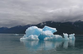
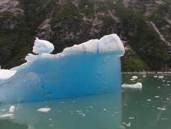
As we neared the entrance to Tracy Arm we met our first iceberg. We were stunned by its color, a really deep blue. Apparently the more compressed the ice (ie the deeper it is in the glacier) the bluer it gets. We quickly discovered that glaciers are not somewhere to sail anywhere near in your own boat.
Our trip boat forced its way through ice flows for about a mile until we were up close and personal and could watch the glacier "calving". Not surprisingly, with all the icebergs around, it was chilly, to say the least!
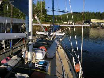
On July 4th we took the ferry 150 miles south to Wrangell and went onboard Ty's boat, Kubapeety. We then began our sail south by following the "Inside Passage" which threads it's way through narrow fjords with high mountains, up to 8000ft, on each side. In Alaska these were all still snow capped, even in July, but as we travelled south the air slowly warmed up and the landscape became less rugged.
Using the Inside Passage makes sense, even the ferries and cruise ships use this route rather than going out to sea. We discovered that, besides generating snow and rain, the high mountains also block the wind, so usually we had to motor over calm seas; there was little fetch so waves didn't build up. As always happens, wherever I sail, when there was wind it would be strong and from ahead. Blowing down off the snow capped peaks it was also bitterly cold. In general we found it was calm in the mornings while a NW sea breeze would blow from noon until dark.
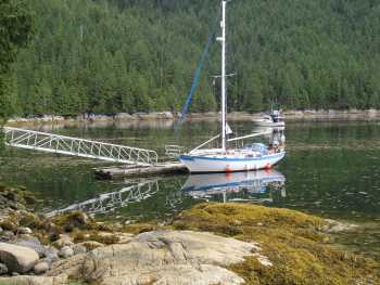
Although the shoreline is never far away, the water is VERY deep, typically 1500ft! (that's 10 times the depth of the English Channel!) So anchorages shallow enough for yachts are few and far between. Thus we often had long distances to travel each day, which meant motoring to ensure a daylight arrival. Ty preferred to go into marinas or alongside government docks, which sure made my life easier. Only once did I have to haul the anchor up from a 100ft depth (there's no powered anchor winch on Kubapeety).
Every report we'd read prior to the trip warned that we would motor everywhere, something we didn't really believe until we got there. True we were on a slow monohull, but we realised that even in Eclipse we would have had to motor much of the way. How Vancouver managed in an unwieldy square-rigged ship and no engine - never mind a lack of charts - is hard to envisage. Places like Dodd Narrows where the tide can run at 15 knots are scary enough when motoring a small sailboat. So we quickly learnt that timing the tidal gates was crucial, apparently at one pass the whole island shakes at peak tides!
The tidal range is about 15ft, so is much the same as in my English home waters. However, instead of two high and two low tides a day sometimes there would be six low tides and two high in 24 hours. In other places I learnt that summer and winter tides are totally different. Very confusing! It's essential to have a tidal stream atlas, not just tide tables.
Maybe we were unlucky with the weather, or maybe what we had is typical; in any event we were in Alaska for three weeks and it rained everyday except three. So we were happy to see the sun come out as we entered Canadian waters at Prince Rupert.
Apart from the scenery and fishing most people come to the NW for the wild life. Whale watching is deservedly popular, as the whole area north of the Johnson Straits is home to orcas, fin whales and humpbacks. Like everyone else we managed to take lots of pictures of swirls of water. But we also saw bear (one), eagles (hundreds), seals (dozens), deer (a few) and otters (three). Fortunately, apart from when we bathed at the Bishop Cove hot springs, we weren't too bothered by mosquitoes.
Apart from the wild life we also kept a good look out for floating logs, or deadheads. However they didn't seem to be the problem we'd been warned about, for we saw very few, but I still wouldn't like to sail here at night.
Maybe deadheads are now less of a problem because commercial fishing and logging are in serious decline throughout the whole Pacific NW. The gold rush is of course long gone, but photos in bars show what it used to be like 100 years ago. We found one typical fishing camp at Namu, now a totally derelict town with just 2 caretakers, yet 2000 people lived there only 30 years ago. It felt a bit like Bodie, the old mining town south of Lake Tahoe, which we'd explored just a few weeks earlier. And once again we had that weird feeling of being watched.
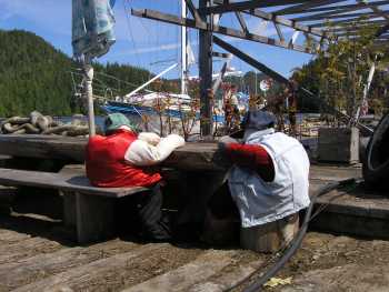
Some camps have been given a new lease of life by becoming upmarket lodges for weekend fishermen. Of these Shearwater seemed the best, with good docks, friendly staff and an excellent restaurant and shop. But even here the evidence of decay was not far away. A short walk led to an abandoned fish processing plant with thousands of dollars of equipment simply left to rust.
There are no roads connecting the towns, so to travel any distance one either goes by boat or float (sea) plane. These small planes land anywhere and so tend to use the same facilities as do yachts. In Shearwater we had to wait to refuel behind a plane - a first for me!
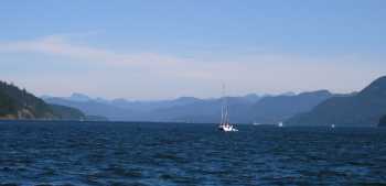
100 miles south of Namu we met our first bit of open water for weeks. As we crossed the southern end of the Queen Charlotte Straits it was great to be able to see a clear horizon, even if only briefly. Like most cruisers we made landfall on Vancouver Island at Port Hardy, the island's most northern marina.
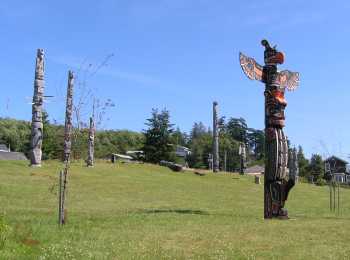
South of Port Hardy the Inside Passage closes in again to form the 90 mile Johnston Strait. Here the wind is funnelled and blows really hard, especially in the afternoons. As the tide runs at 5 knots and it has few good anchorages it is certainly somewhere to take cautiously. So we spent a couple of days at Alert Bay, famous for its totem poles, waiting for high tide to be at a sociable hour and for better weather.
Seymour Narrows at the south end of the Johnston Strait forms the boundary between the cold and wet north and the dry, warm south. We left Kelsey Bay wearing full oilskins, gloves and hats, yet by lunchtime, as we approached Campbell River, we were wearing T shirts and shorts.

People look at us in awe when we say we've sailed in Alaska. But, truth be known, it was actually all very easy. Apart from a few miles at the south end of Johnson Straits I could have sail a dinghy everywhere. So no surprise that the most popular vessels we saw north of Campbell River were kayaks.